Overview
Starting in 2023, I began doing the cartography for the MOVE Across 2 Ranges that happens every February. The event has four trail-difficulty choices, which require completing a hike through the Tortolita Mountains in Marana, then driving to and completing a second hike on the west side of the Santa Catalina Mountains in Oro Valley. At the end there is an after party.
Since the routes change every year, my role is to illustrate the route on each mountain range for every difficulty level. Since there are four levels, it requires 8 maps. With each map I extract DSM elevations along the trail route layer, then export it to Excel. In Excel I prepare the basic elevation profiles. Finally in Illustrator the map and profile are combined into a single graphic. Every year I try to improve upon the previous year.
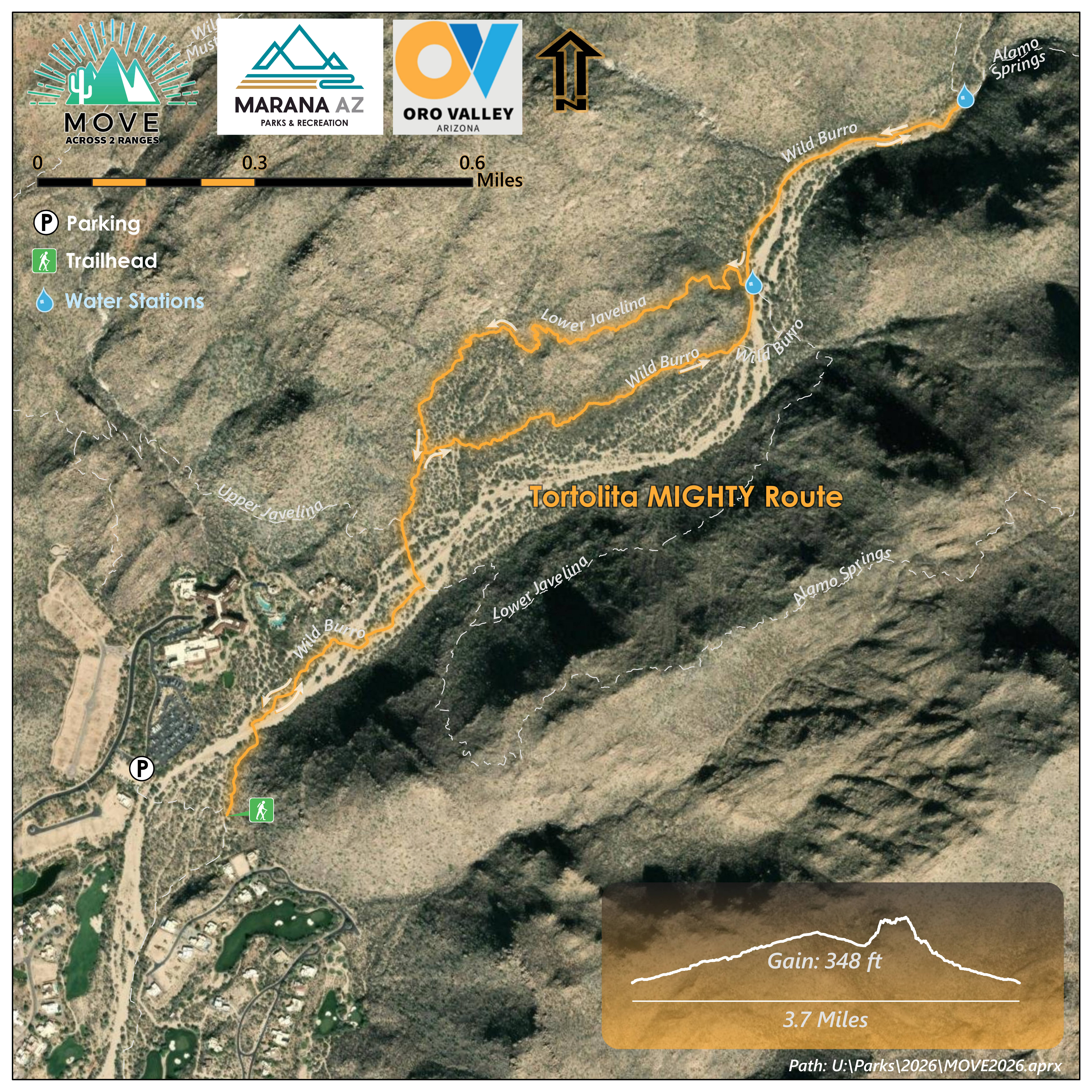
The Tortolita Mountains "Mighty" Route for 2026.
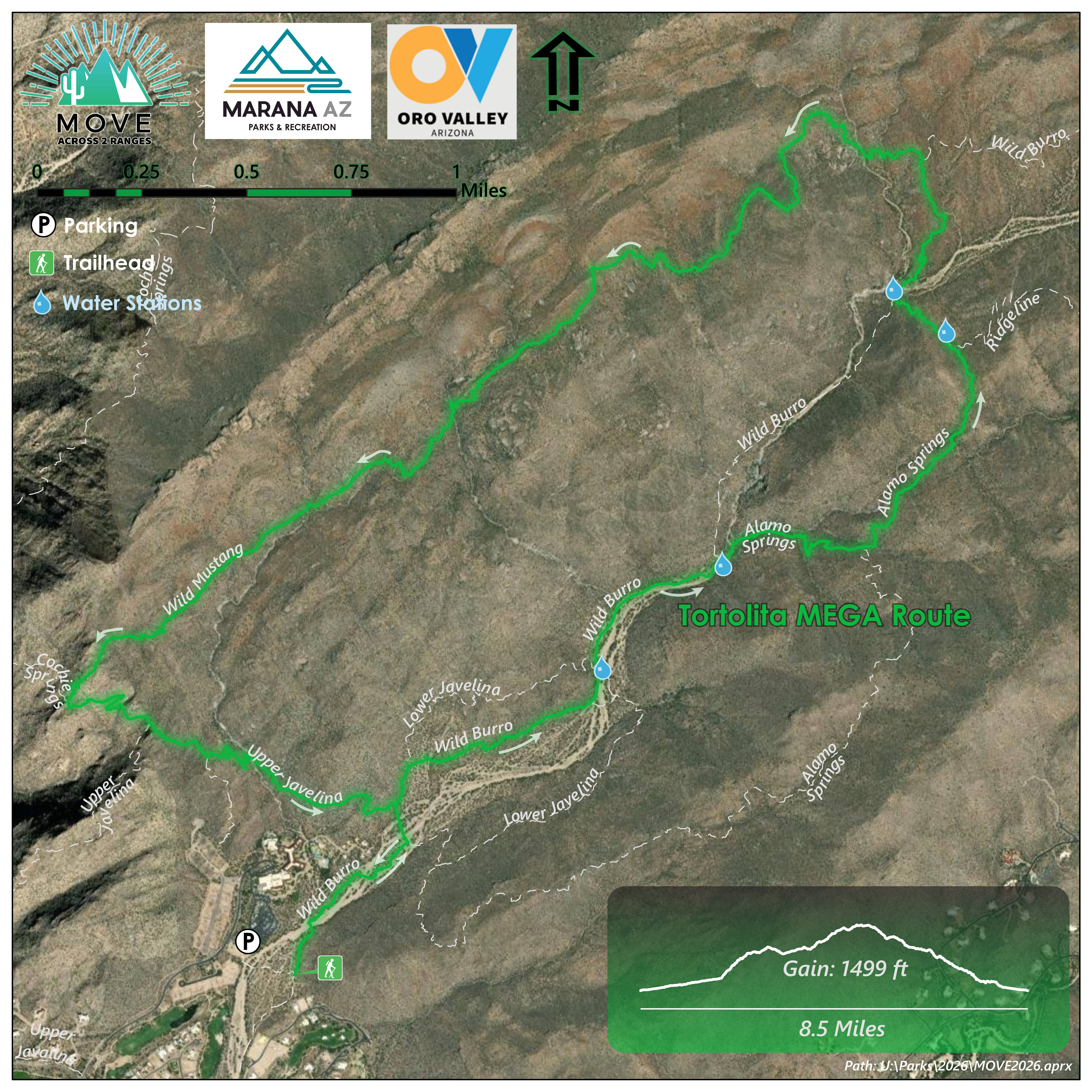
The Tortolita Mountains "Mega" Route for 2026.
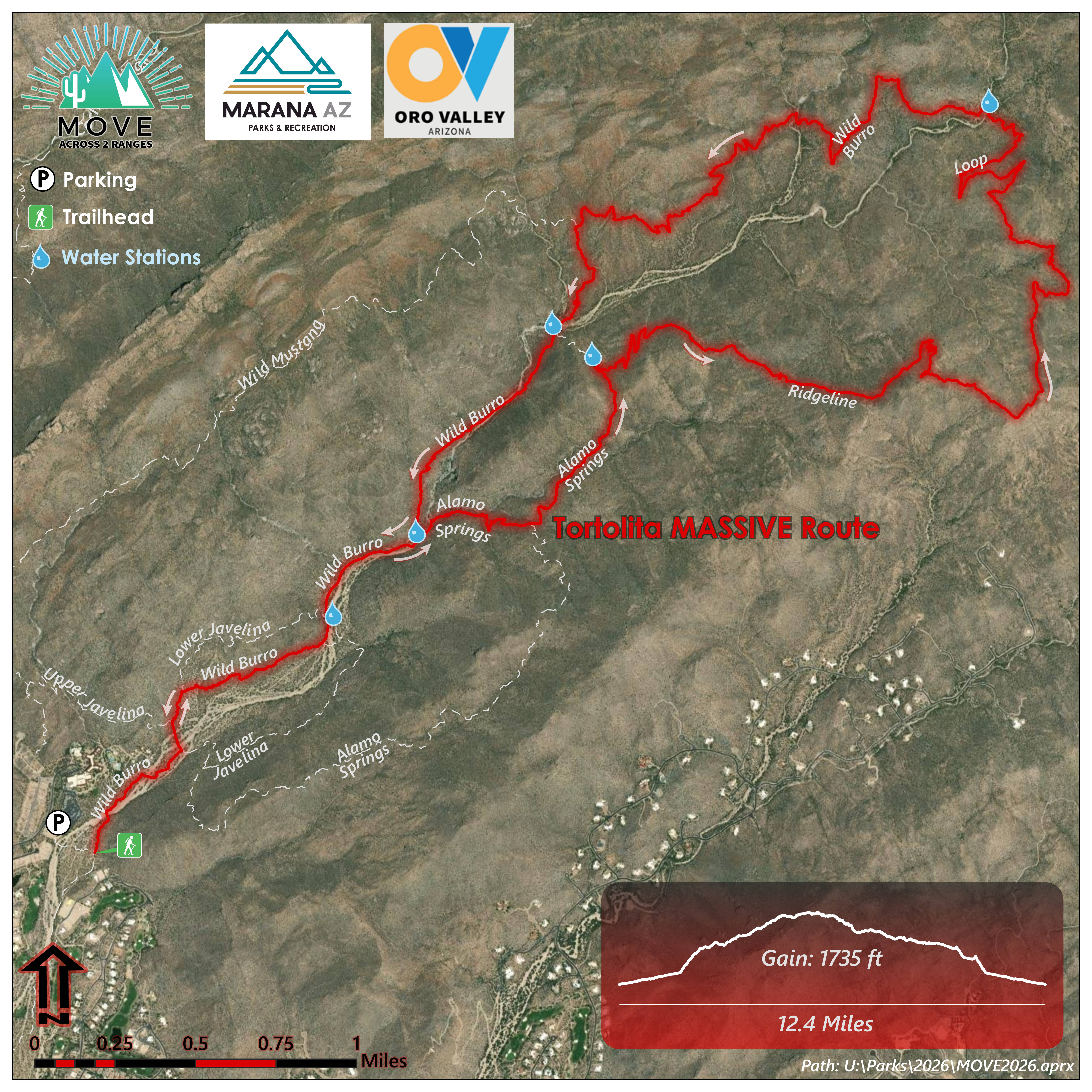
The Tortolita Mountains "Massive" Route for 2026.
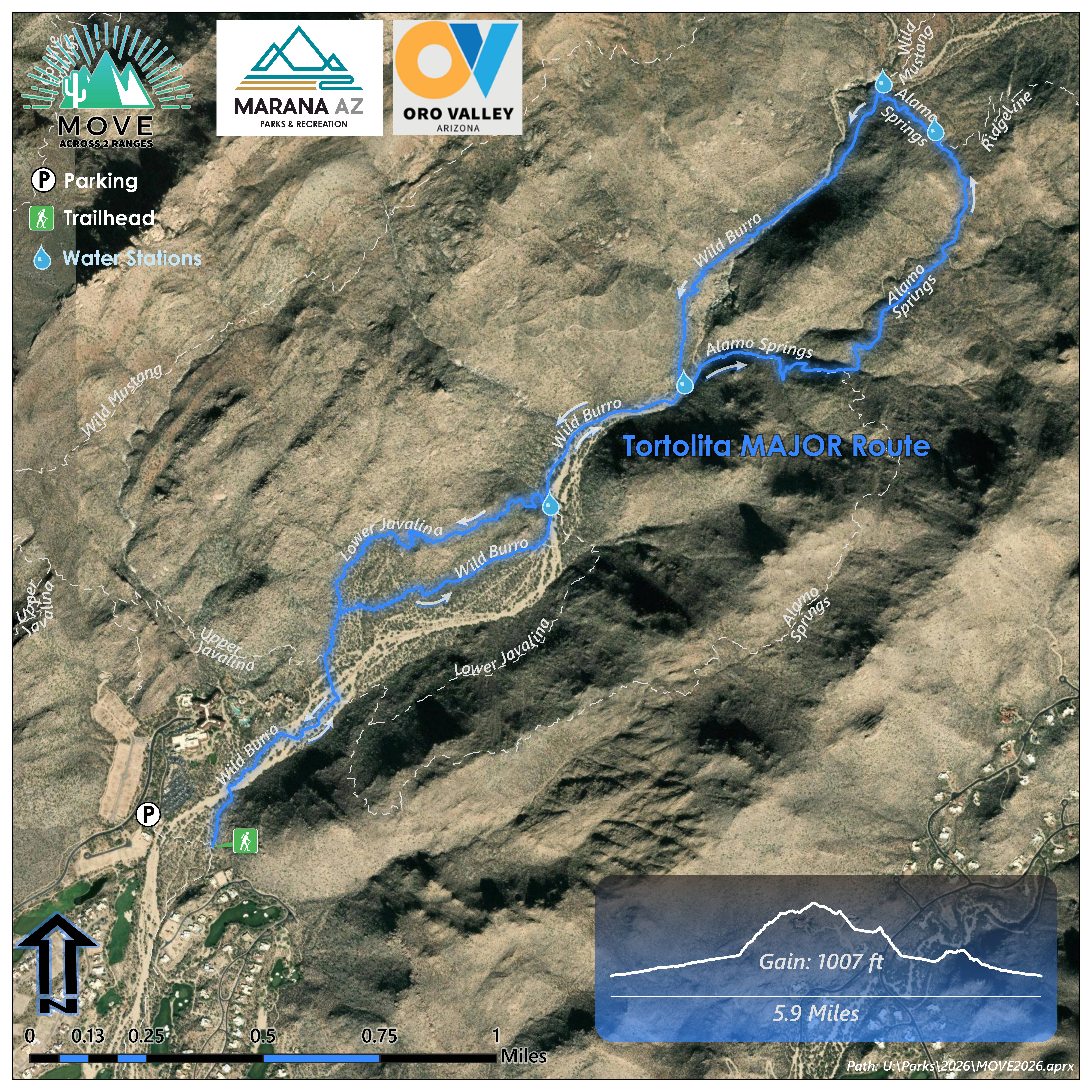
The Tortolita Mountains "Major" Route for 2026.
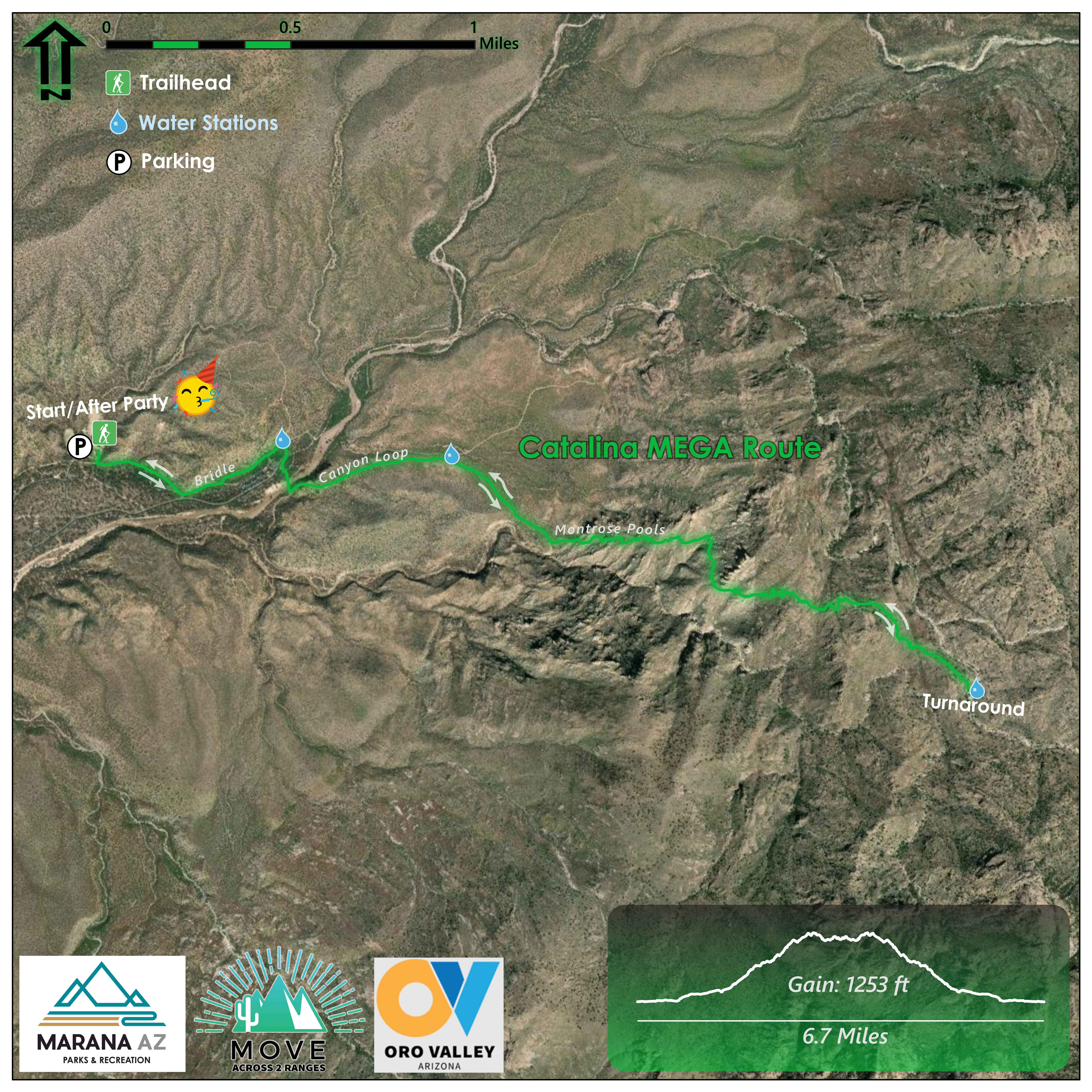
The Catalina Mountains "Mega" Route for 2026.
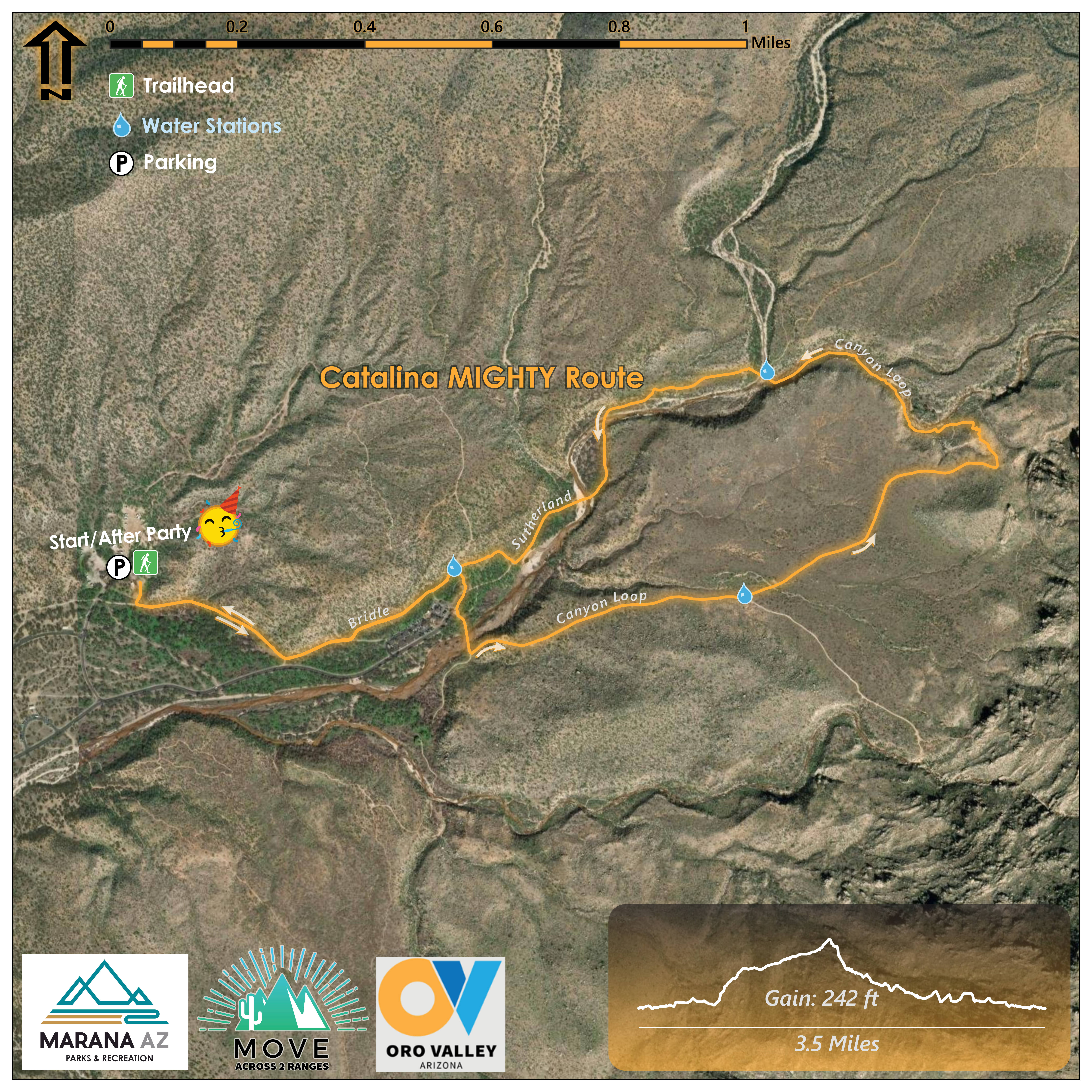
The Catalina Mountains "Mighty" Route for 2026.

I-Frame print for the 2024 event.

I-Frame print for the 2024 event.