Overview
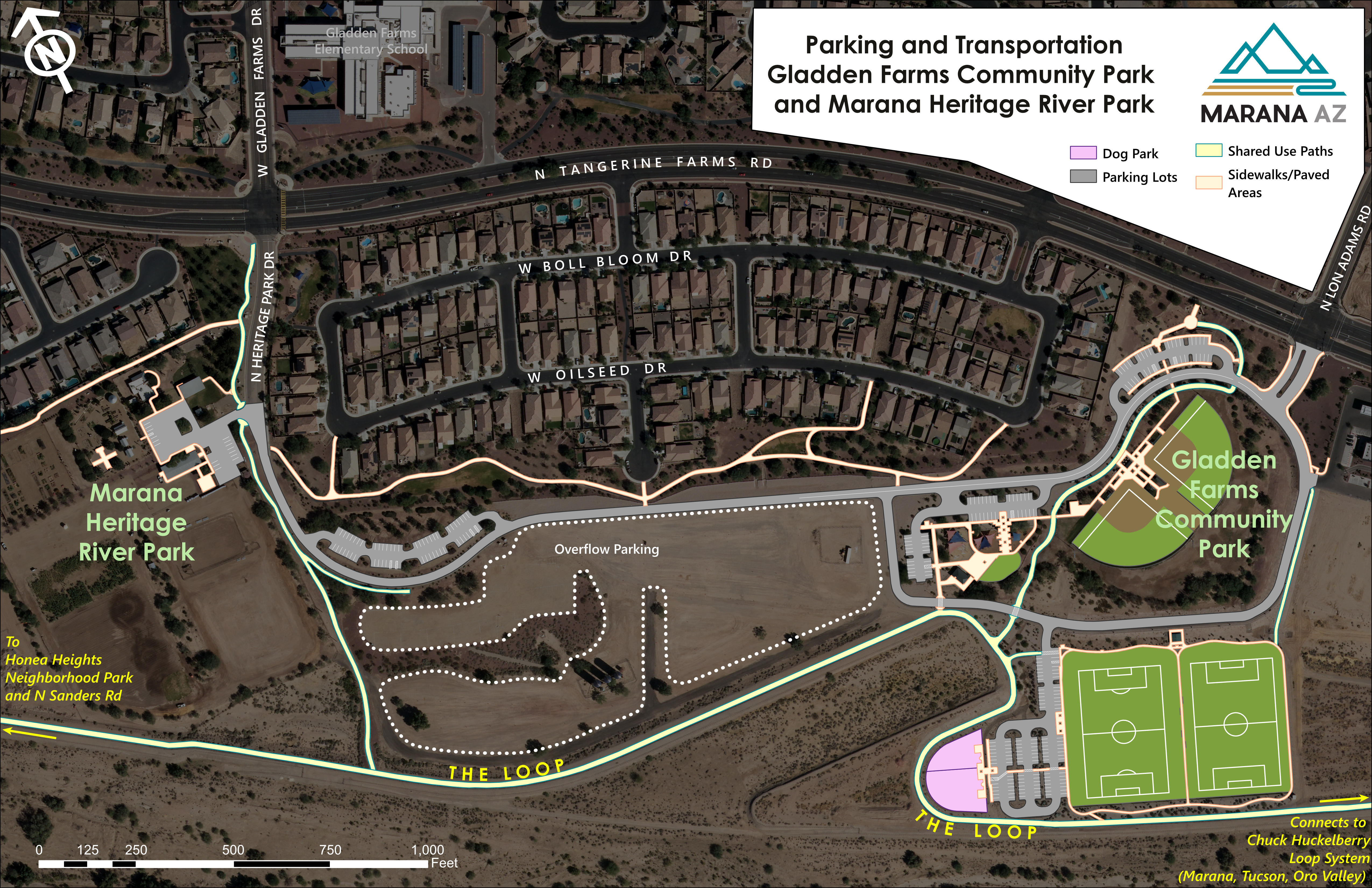
I created maps of all Town of Marana parks. This required visits to parks where I compared old data to existing features. It was an excuse to bring park data up to date. Because Marana is growing rapidly, some park developments outpaced our imagery. Therefore, in the Gladden Farms Community Park, we flew a UAV (drone) to collect up to date imagery, then stitched it together with existing imagery.
Below are some examples of the parks maps that were uploaded to the town's Parks & Recreation website.
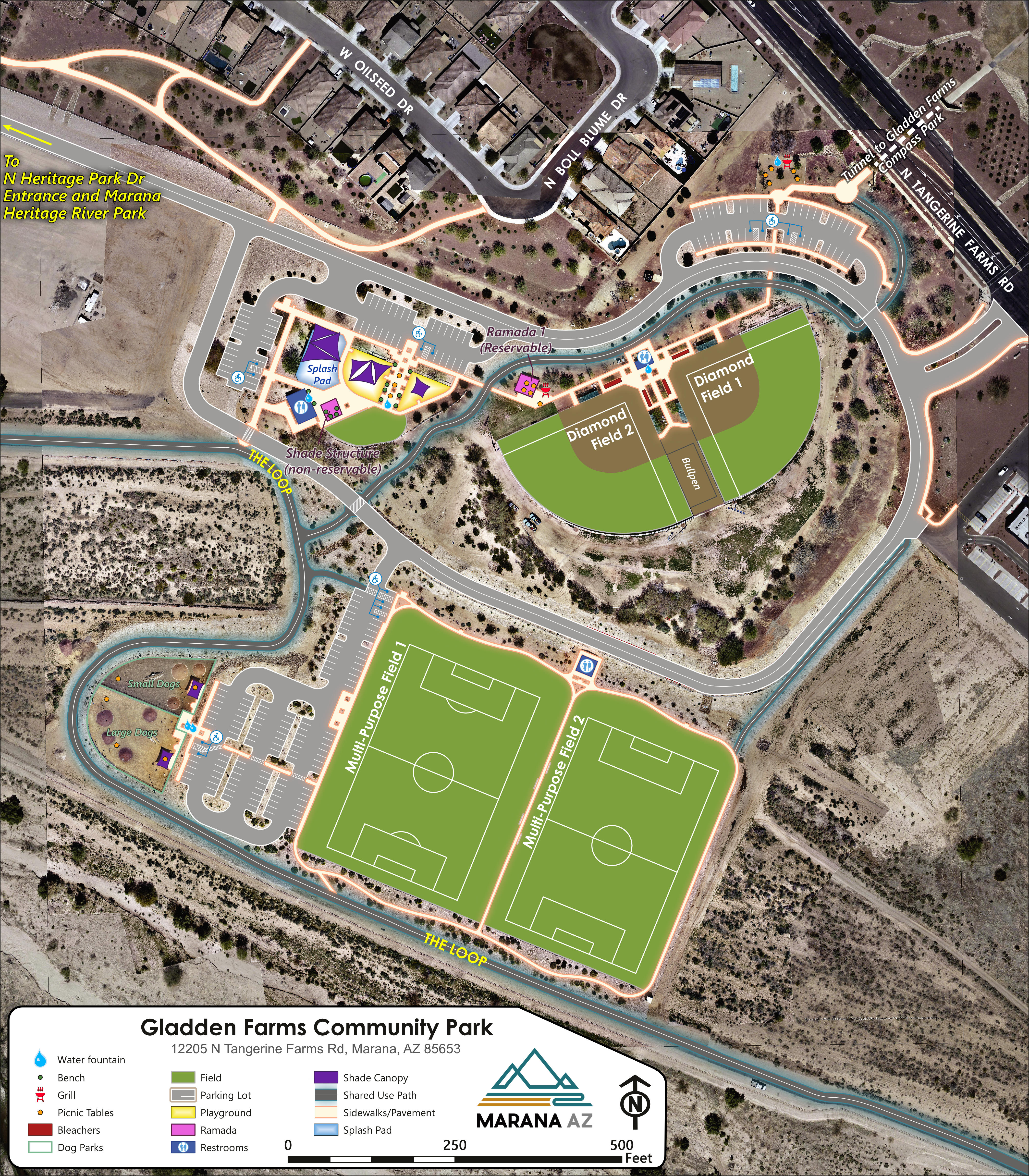
Gladden Farms Community Park. UAV imagery stitched with existing base data.
Riverfront Park.
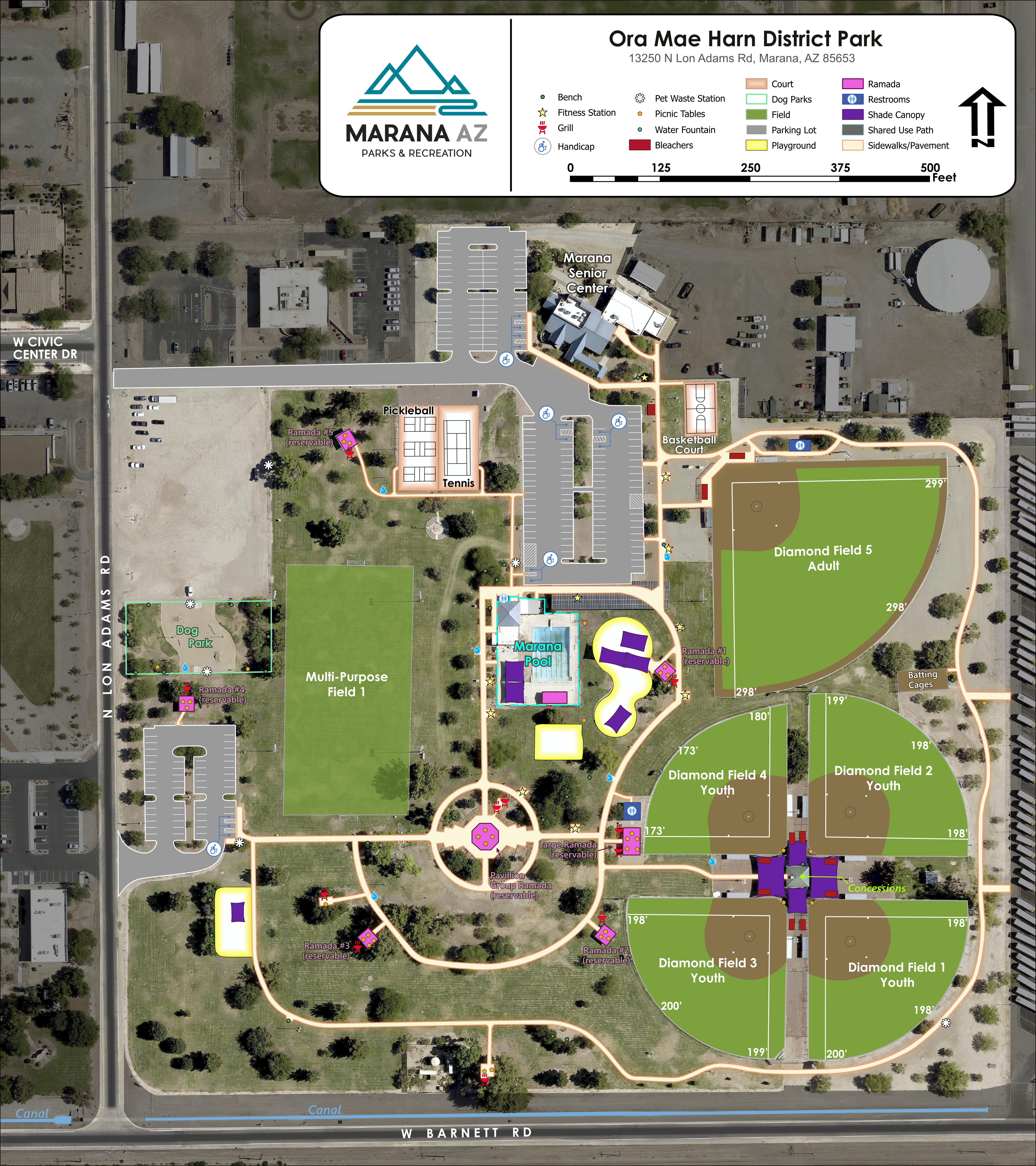
Ora Mae Harn Park.
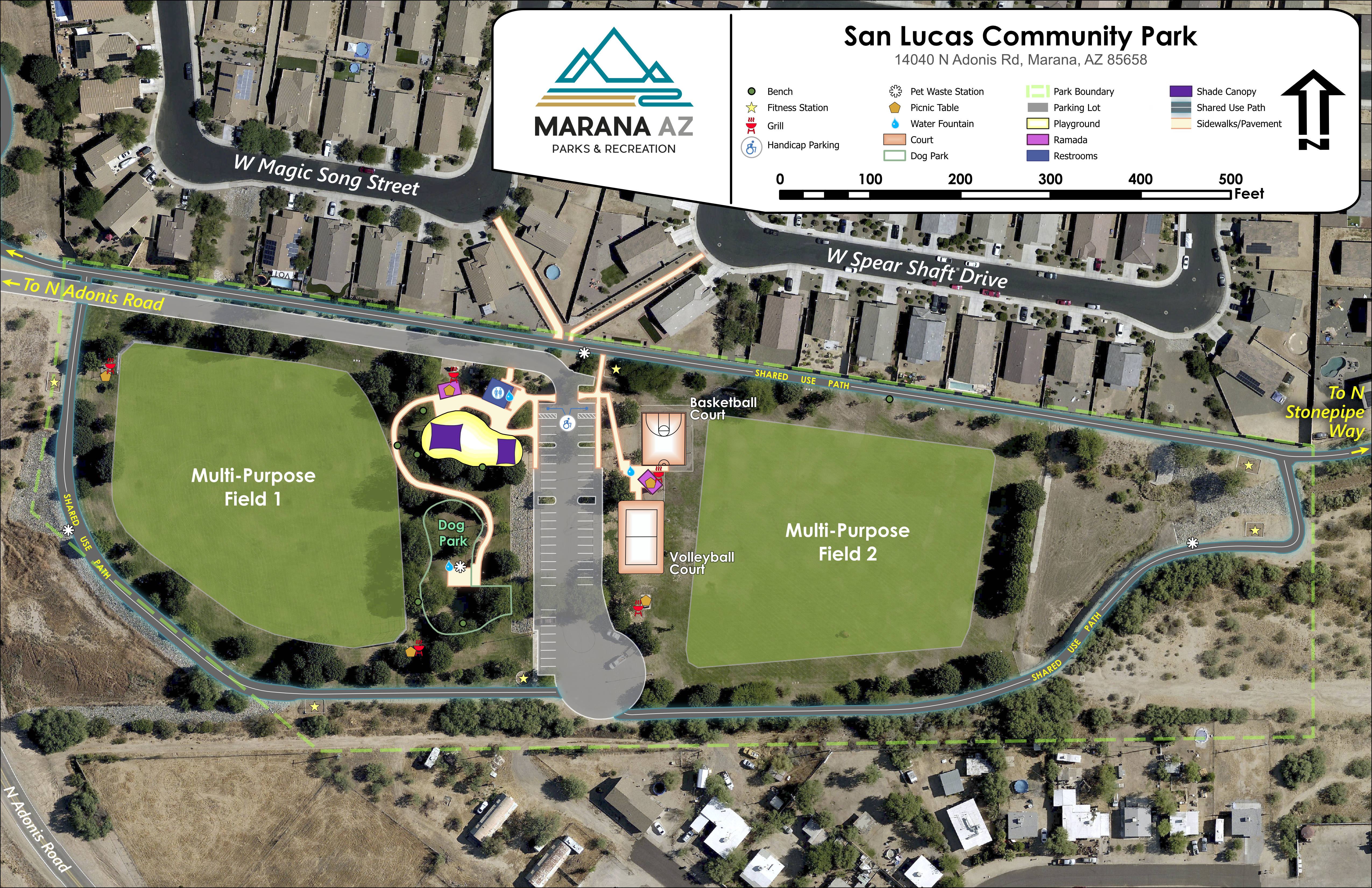
San Lucas Park.
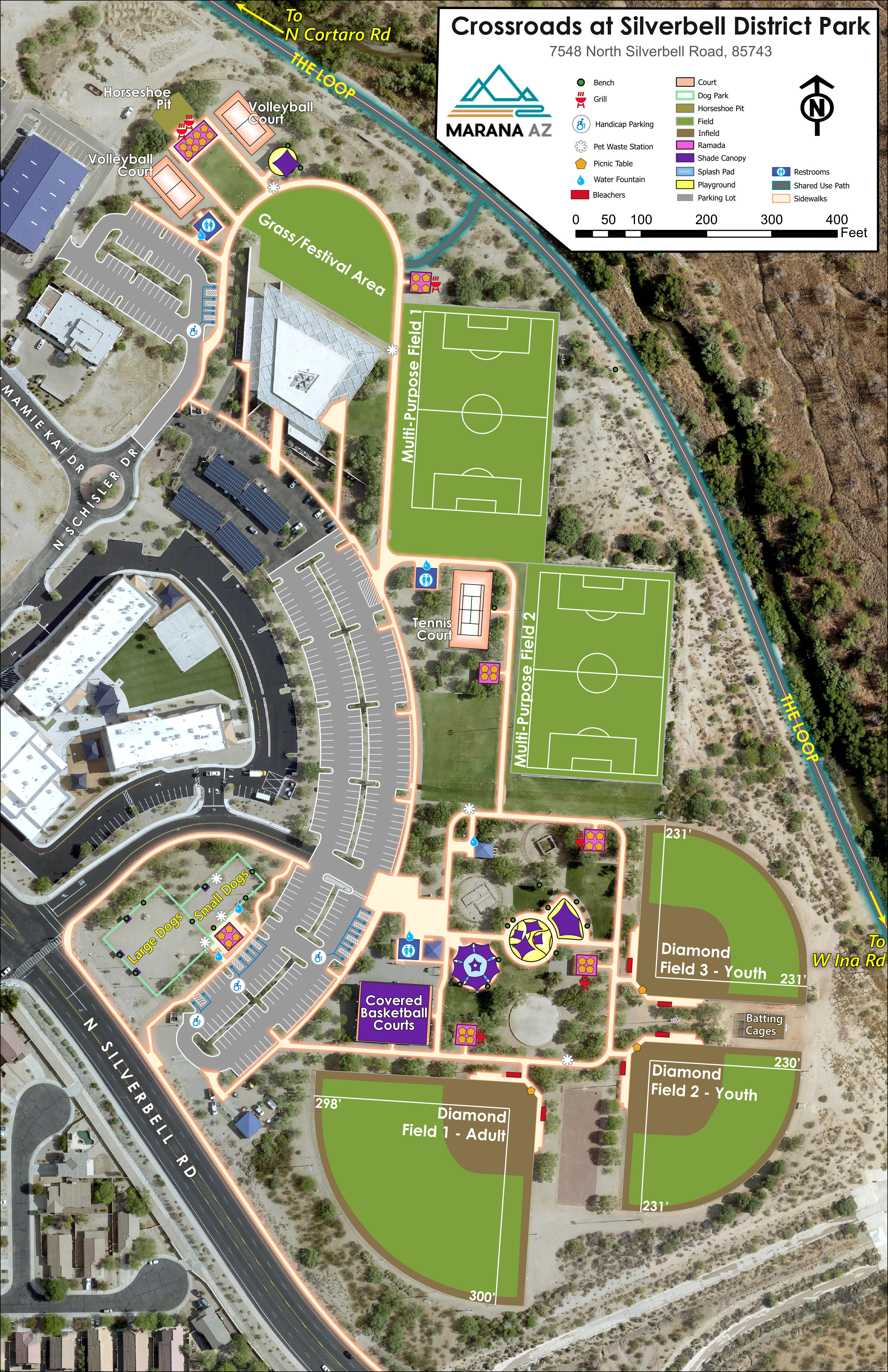
Crossroads at Silverbell Park.
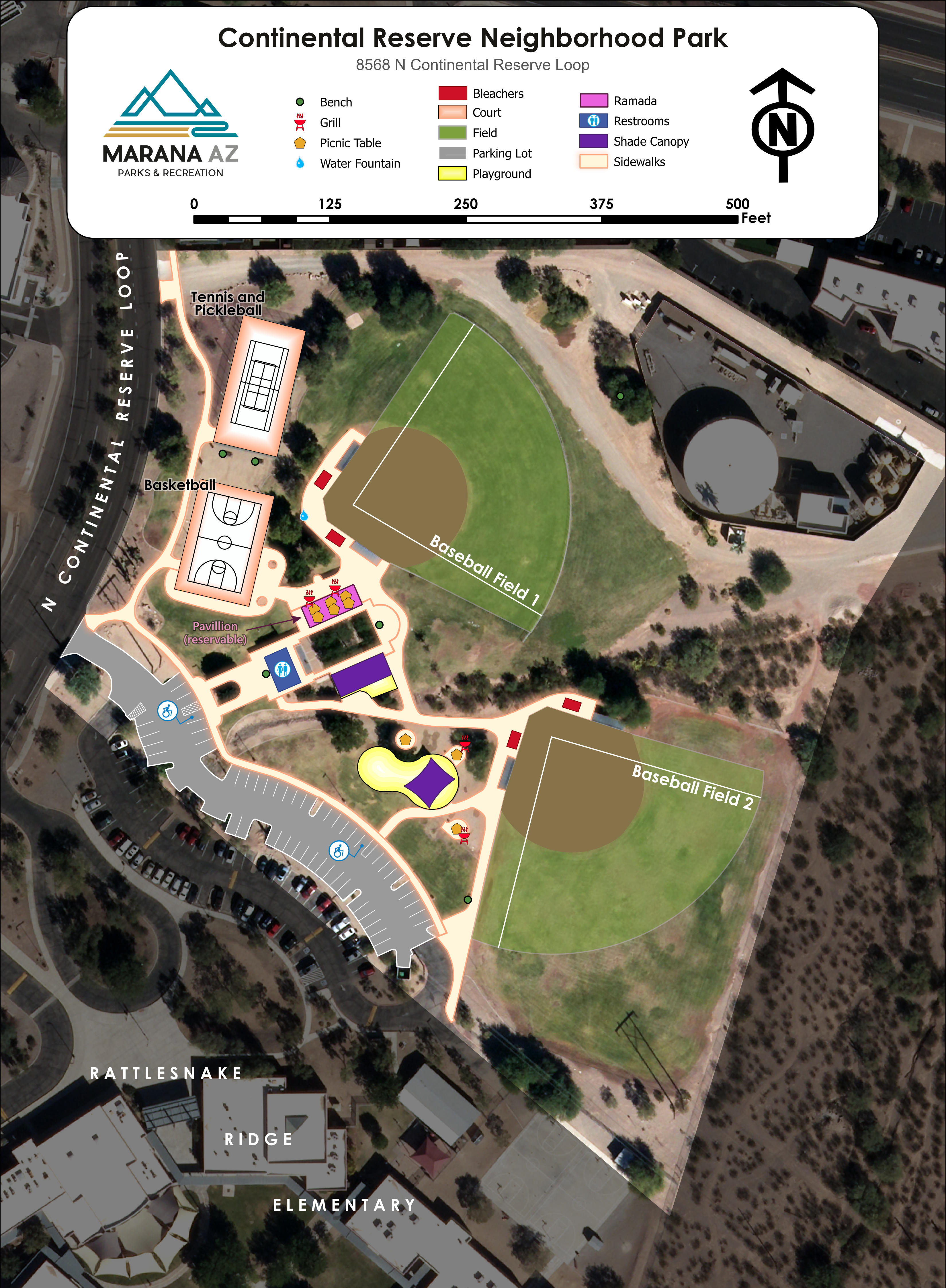
Continental Reserve Park.
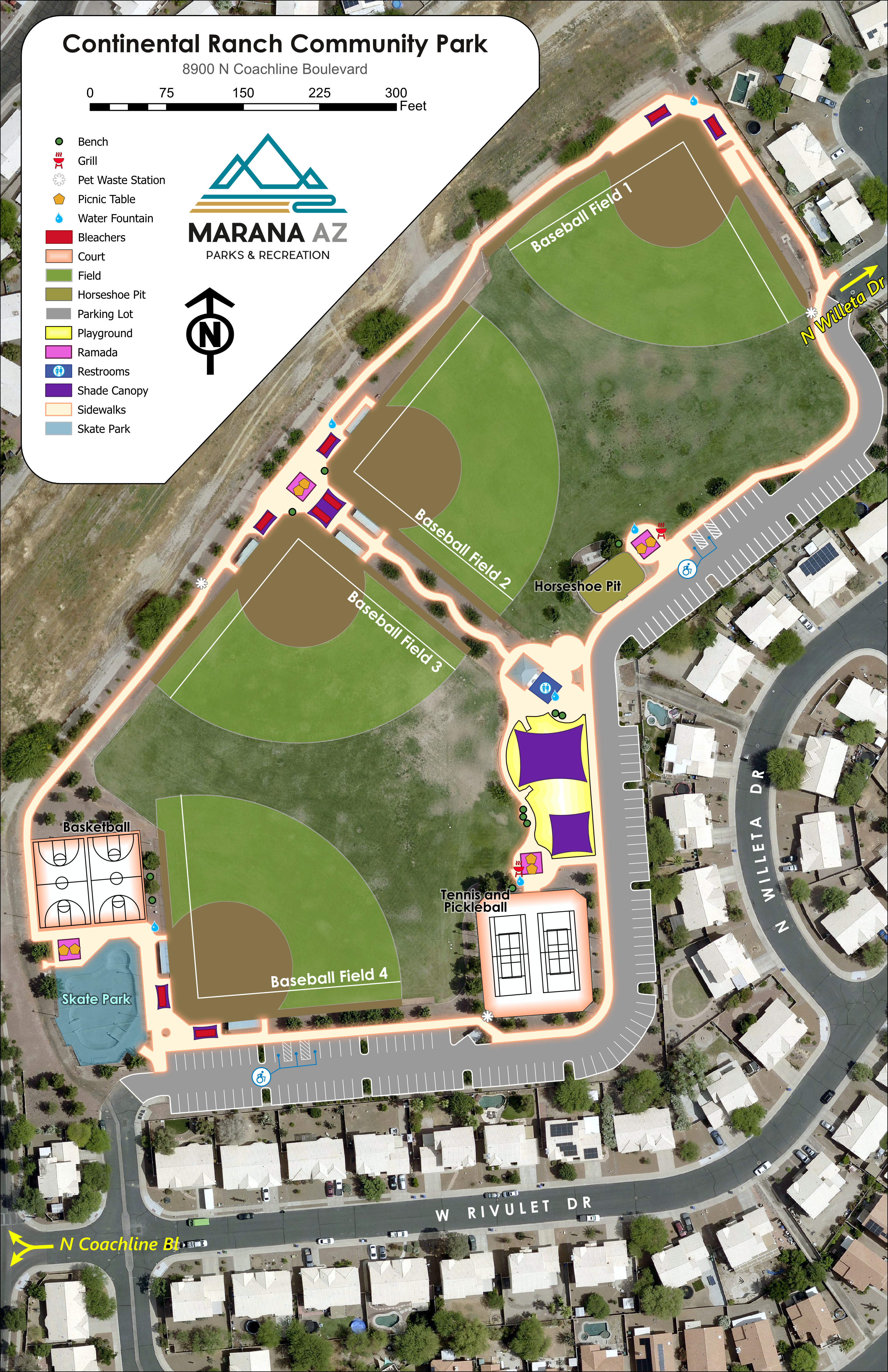
Continental Ranch Park.